Williamstown which lies between Blackrock village and Booterstown, was one of the sites selected for a Martello tower during the Napoleonic era when Britain declared war on the French in 1803, after a brief uneasy peace following the Treaty of Amiens. In response, Bonaparte immediately set up a camp in Boulogne with the aim of invading Britain. The English equally realised they were also susceptible to an attack from an invaded Ireland, and set out to nullify this potential threat. The vulnerable coastline of South County Dublin was considered by the British to be the likeliest starting point for a successful French invasion of Ireland. With the history of Irish rebellion against the yoke of unwanted British rule, together with the probability of strong French naval and military assistance to rebel Irish forces, the British authorities were wary of a united and pro-Napoleon Ireland combining with a strong France to exert a pincer pressure on Britain that might lead to a battle on two fronts. They immediately set out to erect a defensive chain of sixteen Martello towers – some backed up by larger gun batteries – on the South Dublin and Wicklow coastline between Sandymount and Bray at strategic locations. These Martello towers were part of fifty built along the coast of Ireland at the time and were inspired by, and based on the successfully proven Genoese design in the Mediterranean that had held off British naval attacks in 1794 on a similar tower (Torra di Mortella) at Punta Mortello in Corsica.
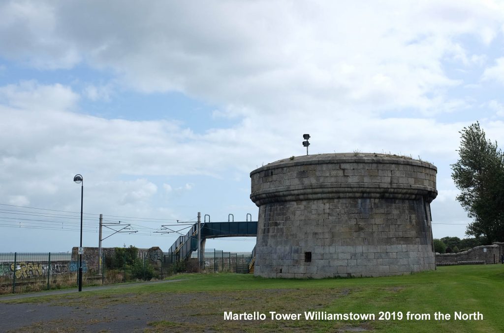
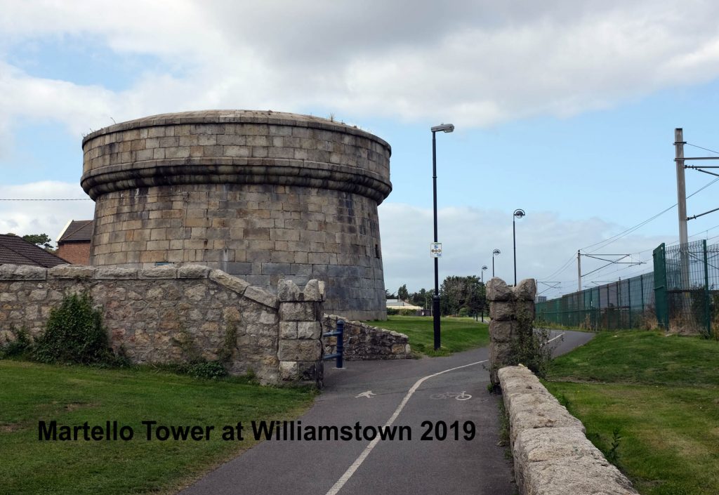
Tower No.15 Booterstown (Williamstown)
The tower here was originally slightly offshore and was surrounded by water as the site had to located there to enable it to signal effectively, by flags, to its neighbouring Martello towers at Sandymount and Seapoint. A little larger in width than the norm to accommodate two guns, it was built roughly 2 kilometres from its south eastern companion tower – No. 14 – at Seapoint and 2.4 kilometres from its north western companion – No. 16 – at Sandymount. The slightly under 1,700 metre range of its two 24 pounder cannons ensured that, in conjunction with the intersecting firing radii of its neighbours’ guns, any attacking ship could be at least severely damaged, or indeed sunk. Defensively, unlike all of the south Dublin towers, the tower at Williamstown does not feature a machicolation to drop boiling oil on ground based attackers, but instead has murder holes above the western doorway within the continuous corbelled courses of the parapet level. Currently, the tower is not occupied, but the intention was expressed in 2013 by the local authority to restore it, and thus enable it to be used by the community. This work has not yet commenced. The tower is located on a large grassed area bordered by a coastal walkway with the Dart line to its east, and can be seen to have degraded, due to the ravages of both time and, unfortunately, the depredation of vandals.
The Dublin to Kingstown rail line, created in 1834, which altered many aspects of the village, also affected the tower, as the track was constructed from Merrion offshore in a south easterly direction past Booterstown and Williamstown across to Blackrock. This restricted the flow of the tides, and resulted in rising marshlands being created between the rail line and the shoreline, and around the tower. This new marsh at Williamstown was filled in when Blackrock Park was created in 1873 and in doing so the ground around the tower was raised and the basement was filled in. The tower now looks much lower, and thus stubbier, than its original aspect would have looked. Judging externally on the current height difference between the sand on the eastern (sea) side of the railway, and the base level of the tower, at least 2 to 3 metres of the original above ground part of the tower is now hidden by soil.
A notable maritime tragedy occurred close to the tower on the 18th November 1807, when a ship – His Majesty’s Packet Prince of Wales which was part of a military convoy filled with Irish recruits heading off to fight Napoleon – was driven ashore in a violent storm just 1.4 kilometre south-east of this area on the rocks close to Blackrock House, the home of Sir John Lees at the time. The storm was so severe the winds allegedly reached hurricane force. That same day, its companion Martello tower at Seapoint had another recruit filled ship ship – the brig Rochdale – driven onto the rocks directly under it. The seas and storm were so fierce, together with driving snow and sleet that reduced visibility to virtually zero, that little could be done at either location to save the crews and passengers, and hundreds of people died within a few yards of the shore. At Seapoint, it was estimated a twelve foot plank would have saved hundreds. After the storm abated, three hundred and eighty five mangled, and virtually unidentifiable, bodies were recovered from the shore (265 from the Rochdale, and 120 from the Prince of Wales) and were buried in the graveyards at Merrion and Carrickbrennan. The captain and crew of the Prince of Wales abandoned the ship and its wretched and doomed passengers of young recruits, and escaped in the ship’s longboat. On Monday 19 November 2007, a commemorative plaque was unveiled on the sea wall beside the Martello tower at Seapoint to remember this awful tragedy.